HIKING HAPPENINGS July 2014
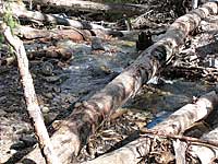
Turning the calendar back to the 1800s, this range was used for grazing sheep and cattle, a practice that continues today. Mining, particularly at Miners Basin, and limited logging also occurred, while a dairy farm owned by the Day family was in operation at Warner Lake. Now, however, most people come here to recreate – hiking, horseback riding, fishing and mountain biking in the summer and fall – snowshoeing, skiing, sledding and snowmobiling in the winter. The name La Sal was originally recorded in the 1776 journals of Dominquez and Escalante, two Franciscan friars on an expedition to find a route between the Catholic missions in California and New Mexico. In those days the La Sals were a prominent landmark on the Old Spanish Trail. Their Ute guides had referred to them as “Sierra de la Sal,” meaning The Salt Mountains - a range that is 25 miles long (north-south) and 15 miles wide (east-west). The Squaw Springs Trail begins on the Geyser Pass Road and ends 4.3 miles later at the La Sal Pass Road. Traveling via the La Sal Pass Road requires a high clearance four-wheel drive, while the Geyser Pass Road is graded gravel suitable for any vehicle, a far more pleasant ride! To get there from Moab go south on Highway 191 for approximately eight miles before turning left at the sign for the Ken’s Lake-La Sal Loop Road followed by a right on to Spanish Valley Drive, which quickly becomes the La Sal Loop Road. After driving approximately 12 miles turn right on the Geyser Pass Road and continue three more miles to the trailhead. Following close upon that delightful interlude I arrive at a grazing allotment fence with a sign “Please Close the Gate.” Once on the other side I’m back in my stride, moseying along to Brumley Creek, which is named for the owner of a sawmill in Gold Basin. As expected, the rapidly melting snow feeds a rapacious course of water that can be heard long before I drop down to it! A log provides a convenient crossing where I take a deep breath, never look down and baby-step my way over the wild rush of water! What a change it will be later in the summer when this portion of Brumley goes underground.
Climbing out of that drainage, the views are spectacular; South Mountain, Tukunikivatz Mountain, Tuk No and the Abajo Mountains slowly pop into sight as I drop down to Squaw Springs - a treasured romantic sojourn of times gone by where a roofless cabin, which had two windows, still stands. A rusted bed frame languishes inside, while pieces of metal and remnants of a cast iron stove scattered on the ground complete the portrayal of a forgotten way of life.
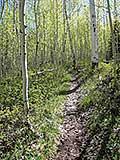
It’s only another mile to the end of the trail, but it is so cool and soothing here I can’t resist a leisurely lunch break in the shade of the whispering aspens to watch the charming waltz of some white butterflies. Bird song fills the air and I tune in to the lyrical lilt of the hermit thrush - the “cheese-bur-ger” mating invitation of the mountain chickadee – the rich melody of the western tanager - and the trumpety call of the red-breasted nuthatch. This sweet setting is such an appealing spot I hate to leave, and so, as usual, I linger much longer than I planned. |
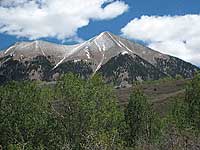 As the summer heat bears down, I once again switch my hiking agenda to the higher elevations of the La Sal Mountains. For thousands of years Native Americans made this seasonal upward migration for hunting and gathering. That influence is reflected in the naming of Tomasaki Peak and Mount Waas after two Ute leaders. Tradition also suggests that the translation of Tukunikivatz is “place where the sun lingers longest” – an appropriate term for one of our more prominent peaks.
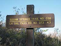 I am fond of hiking the well-marked Squaw Springs Trail. With a minimal increase in elevation, it is not a lung buster; casually it weaves in and out of a patchwork quilt of oaks, aspens, meadows and short stretches of riparian conifer forest. In the open areas long distance vistas steadily roll into view – Mill Creek Canyon, South Mesa, Spanish Valley, Moab Valley, Brumley Ridge, Behind The Rocks and the vast twisted canyonlands that extend clear to the Henry Mountains.
 The La Sals are the second highest range in Utah, after the Uintas. Mount Peale, the highest at 12,721 feet, was named after Albert Charles Peale, a geologist on the Hayden Survey team in 1875. Two passes separate the three mountain groups: La Sal Pass (10,125 feet) and Geyser Pass (10,500 feet). If you’re asking - Where’s the Geyser? Be informed that there isn’t one. This spot is named for Al Geyser, an early cattleman.
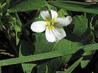 After loading up my pack on an invigoratingly cool morning in early June, I am on my way. The snow is now mostly gone, here at almost 9,000 feet, and the wildflowers are starting to bloom: larkspur, clematis, Oregon grape, white violets, daisies, golden peas, dandelions and the charming nod of the bluebells. The walking is easy, and soon I reach one of my favorite spots - a miniature waterfall that rhythmically dances down a rocky foundation to spill across the trail, where I am enticed to pause and soak in this alpine paradise.
 As I wander through a deep dark forest of conifers towards Dorry Creek - named for the pioneer sheepherder Dorry Crouse - the delightful scent of pine fills the damp pungent air. This lackadaisical creek creates a messy bog of mud that was never any fun to walk through. Wow, what a difference a new wooden bridge makes!
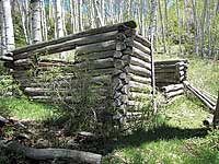 A stream trickles out of the fenced-in spring initiating its short journey through the lush green meadow below the cabin – a perfect pasture for an old timer’s livestock. Surveying the leftover fragments I wonder who built this summer time cabin, and when was it abandoned? How close was their nearest neighbor? Did they like the isolation of living so far from civilization? Back then it was a long arduous ride to Moab to pick up groceries – a trip I am certain they rarely made!