In upper Gold Basin, far beneath the towering peaks of Tukuhnikivatz, Tuk No, Laurel and Peale, a heartbeat of water is born. A century or more ago prospectors searched for gold along its pulsating shores, a man named Brumley operated a sawmill and a rugged dirt road wandered along its banks. The miners and sawmill are long since gone, but parts of that primitive road still exist.
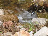 Brumley is an illusive creek. During the full flush of spring runoff, it’s a crazy fool lover surging on a crash course to meet up with Pack Creek. After that huge fling the rush is over, and this fluctuating throb of water has a tendency to mysteriously disappear. Often when it crosses the Squaw Springs Trail, it is shyly tucked away underground, but then a short distance further it re-emerges in a thunderous surge tumbling down a crack in a huge rock wall that is popular with climbers.
By the time this unpredictable flow has reached the pinyon-juniper country, it is usually hunkered down again just barely below the surface where enough moisture sustains a wealth of water loving plants and trees. But whenever we are blessed with an abundance of rain, this secretive stream once again crawls out from under and bounteously runneth over.
 Since the snow has started to fly in the mountains, the time has come to move my hiking venue down to lower elevations. Recently I discovered that at approximately 7,000 feet, a loop walk around Brumley Creek is a perfect location for that transition, and on a gorgeous Indian summer morning in late September I am on my way.
To get there I head south out of town on Highway 191 for approximately eight miles and turn left at the sign for the Ken’s Lake-La Sal Loop Road. At the stop sign I turn right on to Spanish Valley Drive, which quickly becomes the La Sal Loop Road. Then I drive nine more miles and turn on to a dirt road shortly after mile marker 15.
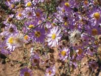
After an abrupt drop, I park, grab my pack and start walking down the jeep road through the pinyon pines and junipers. Immediately I’m stepping over a bright yellow cattle guard, and once my feet are firmly planted on the other side I linger to cherish the clusters of lovely lavender asters; too soon these late bloomers will be gone. Then I turn my concentration to the big picture - a tangled web of mesas, plateaus and canyons - an expansive landscape stretching for miles and miles before it bumps up against the horizontal silhouette of the Henry Mountains and the Abajos - a portrait that never ceases to astound me.
 Eventually I reach a cliff wall crayoned with varying hues of brown, black, yellow and gray. This formidable fortress above the Brumley-Dorry confluence consists of sandstone but deceivingly looks as smooth as polished marble. From the creek’s nourishing bottom Douglas firs shoot up straight and tall, while on top prickly pear cactus precariously cling to the edge, where bolts mark the evidence of climbing activity.
I want a more in-depth look down, and walk ever so gingerly along the edge for a better perspective of this carved out gorge. Then I quickly step back. I’ve had enough of this on-the-edge position! One little misstep and it’s oopsy, daisy, down I go!
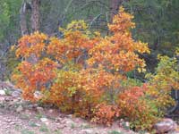
Leaving my cliffside balcony, I mosey on down the road. Passing through a log fence with a wide-open gate, I quickly drop down to the dry creek channel. Now I am under the spell of a riparian paradise filled with the murmurings of fall as I savor the musky cidery fragrance – the flaming oaks – the golden aspen leaves fluttering in the breeze – the changing colors of the box elders - the crackling leaf-crunch underfoot - and the nostalgic sharp crispness of the air on a bluer than blue sky day.
 Once I have walked approximately 1.3 miles, I take a right on to a seldom-used, easy to miss crossing over Brumley’s dry belly to follow a jeep road that goes to the ridge between Brumley and the Dorry Creek drainage. Huffing and puffing I climb up a steep grade through a canopy of oaks until eventually I enter a dryer land dominated by pinyons and junipers. Now I can feast on an unrestricted view across Dorry Canyon and over to the spectacular presence of Mount Tukuhnikivatz and Tuk No, which are flanked expansively in the foothills by the full blown autumnal plumage of oaks and aspens.
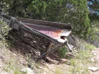
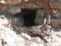
Upward the road travels as it snakes below a rock wall. The further I go, the more encumbered the course becomes with rock debris until there’s hardly any wiggle room left – a narrow, almost impossible passage for many off-road vehicles. Along this upper route two gates must be opened and closed as I march along past three abandoned uranium mines with the remains of a wooden frame structure, a deep tunnel and a metal-lined wooden shoot.
 There are various forks to choose from, but I always pick the more direct course back to Brumley. Then after a long downhill that drops back down through the oaks, I finally reach the creek where water really does flow.
With only a mile left to go in this glorious 6.5 mile hike; I decide it is most definitely time to take a break! Kicking back I relish this relaxed opportunity to continue sampling the essence of fall, while watching a downie woodpecker pecking on a tree, listening to the nasal yank of a white-breasted nuthatch and catching a fleeting glimpse of a Steller’s jay.
After crossing the creek, I go left for the easy stroll back, but with a rapidly descending sun I pick up the pace. Suddenly I slam on the brakes. Whoa, there’s a big brown fuzz-ball ahead - a bear waddling into the road! And what’s more, she has two very small frolicking cubs bringing up the rear! I’d be crazy to argue the right of way with Mama Bear, and I give her a wide berth as she tosses me a cursory glance. Then she and her rambunctious kids wander off into the brush while I ever so cautiously tiptoe on by, continuing my merry way back to my car.
 Brumley is an illusive creek. During the full flush of spring runoff, it’s a crazy fool lover surging on a crash course to meet up with Pack Creek. After that huge fling the rush is over, and this fluctuating throb of water has a tendency to mysteriously disappear. Often when it crosses the Squaw Springs Trail, it is shyly tucked away underground, but then a short distance further it re-emerges in a thunderous surge tumbling down a crack in a huge rock wall that is popular with climbers.
  Since the snow has started to fly in the mountains, the time has come to move my hiking venue down to lower elevations. Recently I discovered that at approximately 7,000 feet, a loop walk around Brumley Creek is a perfect location for that transition, and on a gorgeous Indian summer morning in late September I am on my way.
  Eventually I reach a cliff wall crayoned with varying hues of brown, black, yellow and gray. This formidable fortress above the Brumley-Dorry confluence consists of sandstone but deceivingly looks as smooth as polished marble. From the creek’s nourishing bottom Douglas firs shoot up straight and tall, while on top prickly pear cactus precariously cling to the edge, where bolts mark the evidence of climbing activity.
  Once I have walked approximately 1.3 miles, I take a right on to a seldom-used, easy to miss crossing over Brumley’s dry belly to follow a jeep road that goes to the ridge between Brumley and the Dorry Creek drainage. Huffing and puffing I climb up a steep grade through a canopy of oaks until eventually I enter a dryer land dominated by pinyons and junipers. Now I can feast on an unrestricted view across Dorry Canyon and over to the spectacular presence of Mount Tukuhnikivatz and Tuk No, which are flanked expansively in the foothills by the full blown autumnal plumage of oaks and aspens.
  There are various forks to choose from, but I always pick the more direct course back to Brumley. Then after a long downhill that drops back down through the oaks, I finally reach the creek where water really does flow.