We are lucky to have visions of the La Sal Mountains on our eastern horizon year round. We are even luckier in the summer to have this delightful paradise a short drive away. When it’s sizzling down in the desert, I am so ready for an altitude adjustment, and once again I’m traveling to that high elevation coolness - an ear-popping 6,000 foot journey, which miraculously drops the temperature to an uplifting comfort zone of refreshing cool air.
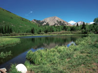 For thousands of years Native Americans made this seasonal high country migration. Their influence is reflected in the naming of two peaks – Tomasaki, a native guide and Waas, a Ute chief - a recognition appropriated to them by members of the Hayden Surveying Party in 1875. Tradition suggests the translation of “Tukuhnikivatz” means place where the sun lingers longest – an appropriate term for one of the more prominent peaks in the La Sals.
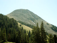 Starting at slightly over 10,000 feet in elevation, the Burro Pass Trail, which goes from the Geyser Pass Road to Warner Lake, quickly delivers the refreshing alpine air that I’ve been craving. From the trailhead, it is almost a mile to Burro Pass and 4.5 miles to Warner Lake. This is the starting point for the Whole Enchilada, a popular mountain bike trail, which runs a 26.5 mile course to the Colorado River – a vertical drop of 7,000 feet.
To get to the Burro Pass trailhead, drive south eight miles on Highway 191 out of Moab. Then, take the left hand turn to Ken’s Lake, go half a mile to the stop sign and take a right on Spanish Valley Road, which turns into the La Sal Loop Road. Approximately twenty miles from town turn right at the sign for the Geyser Pass Road. Then drive eight miles on a graveled road to the pass, which at 10,500 feet has nothing to do with any geothermal activity. Instead, it is named after the early cattleman, Al Geyser.
The last few miles – after the turn off for Gold Basin – are narrow so be prepared to pull over or back up for oncoming vehicles. Not far beyond Geyser Pass, a sign marks a fork in the road – right to Dark Canyon and Highway 46, left for the Burro Pass trailhead. Drive 1.2 miles on the left fork and then look for the left turn to route 2040. Four-wheel drive is highly recommended on this last half-mile section to the trailhead.
Before hitting the trail I pause to admire the southern view - a commanding presence of the two highest peaks in the La Sals. Mount Peale ranks first at 12,721 feet and Mount Mellenthein comes in with a close second at 12,645. Way beyond those prominent landmarks, the San Juan Mountains and Sleeping Ute Mountain in Colorado cast their dreamy profiles against a hazy, far distant horizon.
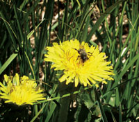
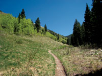
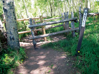
The trail officially begins at a wooden turnstile, followed immediately by a bright yellow cattle guard. Right away I’m enjoying a pleasurable stroll through the cooling shade of aspens, firs and spruce, which open up to spacious meadows where the early season wildflowers - dandelions, wild parsley, buttercups and other petite yellow beauties are way ahead of the big rush yet to come.
Constantly hearing the sharp “krak” of Clark’s nutcrackers, I observe their movements as they fly in and out of the trees. Close relatives to jays, these corvids have a pouch under their tongue that holds up to 150 cone seeds, which are buried in the ground for later consumption for them and their offspring. Caching as many as 98,000 seeds per season, they demonstrate a remarkable long-term spatial memory to find a large percentage of their harvest up to nine months later - even when buried under three feet of snow!
With a view of Mount Tomasaki to my right and Manns Peak straight ahead, I forge on until a short series of switchbacks swing me up to Burro Pass. At 11,180 feet, I have gained approximately 1,000 feet in elevation. Phew! No wonder I’m feeling breathless!
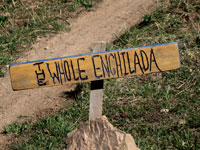
A wooden post with several arrows indicates the direction for two different trails – straight for Warner Lake and right for Deep Creek, which quickly peters out, but it is a commonly used route to access Manns Peak. A new sign has also been added for “The Whole Enchilada.”
After a short break to catch my breath, I continue down the sharp switchbacks on the north-facing slope where I enter the deep shade of firs and spruce. Now my feet sink into the cushioning softness of pine needles - with the pungent earthy smell of turpentine, the world around me is soothingly silent.
When the trail finally mellows out to a more moderate descent, I begin the search for that special spot to take a break. Soon I readily accept an invitation to plop down on a cushy field of green grass where I can enjoy the drowsy warmth of sunshine and the melodious music that fills the air - the bouncy voice of the ruby-crowned kinglet and the haunting flute song of the hermit thrush. During this concert, I am entranced with the whimsical dance of a variety of butterflies - Milbert’s tortoiseshell, painted lady, swallowtail and mourning cloak all join in for the waltz from flower to flower.
This is sweet, but I can’t stay here forever and reluctantly I leave. A short time later as I’m nonchalantly strolling down the trail, a swarm of small bees buzzes in to investigate my shirt. Much to my relief, they leave in a huff when they discover that this is not a big blue flower after all!
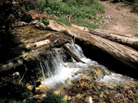 Eventually the trail descends to where the soothing waters flow – the wet fork of Mill Creek. At least six stream crossings are ahead, but in this year of below average snow pack, it is easy to keep your feet dry. In this wetter region I often linger so I can study the colorful bouquets of wild geraniums, iris and larkspur, which are partial to a damp habitat.
At last the home stretch gives me a boost as I travel the slightly elevated path through huge groves of aspens. As always, I am mesmerized with those heart-shaped leaves that flutter and rustle in the breeze.
Wandering through the opening in a rail fence, I walk on past the left fork for the trail to Oowah Lake. Shortly after that, I’m at Warner Lake where I stop to admire Haystack Mountain and its impressionistic reflection on the crystal blue water – an idyllic conclusion to my high alpine summertime retreat.
 For thousands of years Native Americans made this seasonal high country migration. Their influence is reflected in the naming of two peaks – Tomasaki, a native guide and Waas, a Ute chief - a recognition appropriated to them by members of the Hayden Surveying Party in 1875. Tradition suggests the translation of “Tukuhnikivatz” means place where the sun lingers longest – an appropriate term for one of the more prominent peaks in the La Sals.
  Starting at slightly over 10,000 feet in elevation, the Burro Pass Trail, which goes from the Geyser Pass Road to Warner Lake, quickly delivers the refreshing alpine air that I’ve been craving. From the trailhead, it is almost a mile to Burro Pass and 4.5 miles to Warner Lake. This is the starting point for the Whole Enchilada, a popular mountain bike trail, which runs a 26.5 mile course to the Colorado River – a vertical drop of 7,000 feet.
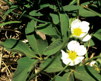
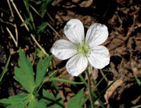
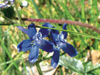
 Eventually the trail descends to where the soothing waters flow – the wet fork of Mill Creek. At least six stream crossings are ahead, but in this year of below average snow pack, it is easy to keep your feet dry. In this wetter region I often linger so I can study the colorful bouquets of wild geraniums, iris and larkspur, which are partial to a damp habitat.