HIKING HAPPENINGS July 2011
Hazzard County Trail – Returning To The High Country
article and photos by Marcy Hafner
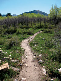 “Hazzard County Trail?” - No one seems to know where that extremely odd name came from, but for a lot of people it triggers memories of the old TV show the “Dukes of Hazzard.” Regardless, no “hazards” exist on this delightful, easy-going three mile stroll in the foothills of the La Sal Mountains, which connects Warner Lake at the elevation of 9350 feet to the La Sal Loop Road at 8300 feet. “Hazzard County Trail?” - No one seems to know where that extremely odd name came from, but for a lot of people it triggers memories of the old TV show the “Dukes of Hazzard.” Regardless, no “hazards” exist on this delightful, easy-going three mile stroll in the foothills of the La Sal Mountains, which connects Warner Lake at the elevation of 9350 feet to the La Sal Loop Road at 8300 feet.
Assisted by the Trail Mix – an advisory committee to Grand County in the development and maintenance of non-motorized trails - the U. S. Forest Service recently constructed the Hazzard County Trail as part of the Whole Enchilada Trail system. This popular 26.5 mile mountain bike trail starts at the Burro Pass Trailhead and joins the Hazzard County Trail shortly after passing Warner Lake. At the La Sal Loop Road, it continues down the Kokopelli Trail, and follows the Upper Porcupine Singletrack, Lower Porcupine Singletrack and the Porcupine Rim Trail to the Colorado River - a vertical drop of 7,000 feet.
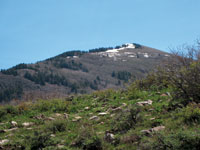 It takes less than an hour to drive the estimated 35 miles to Warner Lake, where the upper end of the Hazzard County Trail begins on the left just before the lake. The big advantage of starting here is that it is downhill most of the way. On my hike in early June, however, the road to Warner Lake was still closed, eliminating the option of a shuttle. So instead, I parked at the lower end on the La Sal Loop Road and hiked the entire six mile round trip. I was forced to go twice the mileage, but I also experienced twice the pleasure of a different perspective each way. On my way up I was constantly gazing at the shifting mountain views of Gold Knob, Haystack, Tomasaki, Manns, Tukuhnikivatz and Tuk No. Going down, my vision switched to the dramatic scenery of Bald Mesa, Castle Valley, Round Mountain, Castle Rock, the Sand Flats Recreation Area, Arches National Park, Porcupine Rim, northern Moab Valley, Behind The Rocks and the Bookcliffs - with the Henry Mountains finally popping up on the far distant western horizon. It takes less than an hour to drive the estimated 35 miles to Warner Lake, where the upper end of the Hazzard County Trail begins on the left just before the lake. The big advantage of starting here is that it is downhill most of the way. On my hike in early June, however, the road to Warner Lake was still closed, eliminating the option of a shuttle. So instead, I parked at the lower end on the La Sal Loop Road and hiked the entire six mile round trip. I was forced to go twice the mileage, but I also experienced twice the pleasure of a different perspective each way. On my way up I was constantly gazing at the shifting mountain views of Gold Knob, Haystack, Tomasaki, Manns, Tukuhnikivatz and Tuk No. Going down, my vision switched to the dramatic scenery of Bald Mesa, Castle Valley, Round Mountain, Castle Rock, the Sand Flats Recreation Area, Arches National Park, Porcupine Rim, northern Moab Valley, Behind The Rocks and the Bookcliffs - with the Henry Mountains finally popping up on the far distant western horizon.
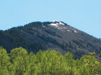
To get to Warner Lake from Moab, go south on Highway 191 approximately 7.5 miles and turn left at the sign for the Ken’s Lake-La Sal Loop Road. Continue half a mile to the stop sign at the tee and turn right on to the Spanish Valley Drive-La Sal Loop Road. You will go past the turn-offs for Pack Creek Ranch, Geyser Pass and Oowah Lake. The next major road on your right after Oowah has a sign pointing to Warner Lake. This five mile graveled road is suitable for any vehicle, but is only open during the summer and early fall seasons. By late September or early October, depending on the weather, the possibility exists that the road will be closed for the winter.
If you wish to start from the La Sal Loop Road, continue a few miles past the turn-off for Warner Lake for a few miles. Shortly after the sign for the Sand Flats Road, there will be a small sign for the Hazzard County Trail on your right, and a large sign for the Kokopelli Trail on your left.
This route, which steadily winds its way in the direction of Gold Knob, is interspaced with aspen g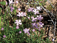 roves, oaks and a refreshing growth of green grass. It even wanders past several small groves of ponderosa pines, which are not commonly found on this side of the La Sals. The distinctive profile of this elegant pine, a favorite of mine, immediately grabs my attention. Its characteristic long needles, which grow in tufts of three, make it so easy to identify, and up close the rustic brownish-orange bark has a faintly pleasing vanilla-butterscotch smell. roves, oaks and a refreshing growth of green grass. It even wanders past several small groves of ponderosa pines, which are not commonly found on this side of the La Sals. The distinctive profile of this elegant pine, a favorite of mine, immediately grabs my attention. Its characteristic long needles, which grow in tufts of three, make it so easy to identify, and up close the rustic brownish-orange bark has a faintly pleasing vanilla-butterscotch smell.
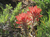 The wildflowers - larkspur, Indian paintbrush, golden pea, mouse-earred chickweed, bluebells and phlox – are commencing their colorful fling. The aspens are greening up - soon the mesmerizing dance of the aspen leaves will begin. The oaks have yet to stir from their winter dormancy; without any fresh foliage, they look starkly naked, which provides me with an unobstructed look at a warbling vireo - a small, drab bird, who generally sings from high in the thick canopy. Normally heard, but frustratingly not seen - today, this seldom seen bird has nowhere to hide! And so I stop to observe his unusual appearance and listen to his rapid warbling, which has been interpreted in one guidebook as – “if I sees you, I will seize you, and I’ll squeeze you till you squirt!” The wildflowers - larkspur, Indian paintbrush, golden pea, mouse-earred chickweed, bluebells and phlox – are commencing their colorful fling. The aspens are greening up - soon the mesmerizing dance of the aspen leaves will begin. The oaks have yet to stir from their winter dormancy; without any fresh foliage, they look starkly naked, which provides me with an unobstructed look at a warbling vireo - a small, drab bird, who generally sings from high in the thick canopy. Normally heard, but frustratingly not seen - today, this seldom seen bird has nowhere to hide! And so I stop to observe his unusual appearance and listen to his rapid warbling, which has been interpreted in one guidebook as – “if I sees you, I will seize you, and I’ll squeeze you till you squirt!”
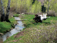
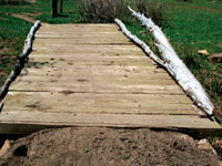 After climbing over a crest and then crossing a wooden bridge, the trail ends at the parking area for the trailhead. At this spot, I’m at 9500 feet, and since I have gained 1200 feet in elevation, the revelation hits me that the higher I have hiked, the more penetrating the breeze has been. Suddenly I am ready to break away from that chilly biting breeze - a dramatic change from the warmer temperatures below. The bank on a sweet, clear flowing creek in the midst of some aspens suits me just fine. The gurgling of the stream, the soothing call of a raven and the sheltered sunny warmth entices me to kick back and stick around. After climbing over a crest and then crossing a wooden bridge, the trail ends at the parking area for the trailhead. At this spot, I’m at 9500 feet, and since I have gained 1200 feet in elevation, the revelation hits me that the higher I have hiked, the more penetrating the breeze has been. Suddenly I am ready to break away from that chilly biting breeze - a dramatic change from the warmer temperatures below. The bank on a sweet, clear flowing creek in the midst of some aspens suits me just fine. The gurgling of the stream, the soothing call of a raven and the sheltered sunny warmth entices me to kick back and stick around.
A green-tailed towhee openly sings his song while perched on an aspen branch. Normally, all his activities are ground-centered as he forages for food by rapidly kicking backward with both feet to expose insects, seeds and berries – a technique that is known as “double-scratching.” Today, however, the hormones have kicked in and all caution is thrown to the wind in his effort to attract a mate as he shows off his attractive plumage - white throat, rufous cap and long bright yellow-green tail that glistens in the sunlight.
The firs that highlight the nearby crest and the fluting song of the hermit thrush – a bird partial to deep forests - remind me that I am at a transition zone – the threshold to the higher elevations, which is a wonderful refuge from the desert heat. With so much grandeur that surrounds me, I savor this alpine interlude as I gaze at these majestic mountain peaks – all of them still partially cloaked in snow. It feels wonderful to be back to the high country and as the summer heat intensifies, I’ll be retreating to this cool heavenly haven again and again.
|
Biological Soil Crust (aka)
Cryptos (krip’ tose):
The surface of
Moab’s desert is held
together by a thin skin of living organisms known as cryptobiotic
soil or cryptos. It has a lumpy black appearance, is very
fragile, and takes decades to heal when it has been damaged.
This soil is a critical part of the survival of the desert.
The cryptobiotic organisms help to stabilize the soil, hold
moisture, and provide protection for germination of the seeds
of other plants. Without it the dry areas of the west would
be much different. Although some disturbance is normal and
helps the soil to capture moisture, excessive disturbance
by hooves, bicycle tires and hiking boots has been shown
to destroy the cryptobiotic organisms and their contribution
to the soil. When you walk around Moab avoid crushing the
cryptos. Stay on trails, walk in washes, hop from stone to
stone. Whatever it takes, don’t crunch the cryptos
unless you absolutely have to! |

Cryptobiotic soil garden
|
|
|