HIKING HAPPENINGS
October 2009
Miners Basin Pass – Where Did The Summer Go?
by Marcia Hafner
When the pages on the calendar start to turn from October to November, I am reminded of how quickly the seasons keep fleeting by. Now that we are fast-forwarding through fall, I wonder - How could those pleasurable high elevation days of summer have whizzed by so fast? Where did the summer go?
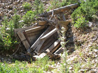 Reluctantly I wrapped up my idyllic summer sojourns with a hike in Miners Basin; a favorite haunt because it is an outdoor experience steeped in the historical lure of gold. The rush for riches started over a hundred years ago when mines mushroomed everywhere around the basin, and at the breathtaking elevation of 9300 feet a town referred to only as “The Basin” was born. By July 1898, the population had swelled to 70, and that included twelve women. This bustling town had a grocery store, two restaurants, two saloons, a hotel and boarding house where dances were held, livery and feed stable, shoemaker’s shop, mining office, recorder’s office, a deputy sheriff, and a post office. Some old buildings and mines have survived the elements and what remains is just enough to spark the imagination of a populace that lived here over a century ago. The gold discovered in 1897, however, turned out to be a low-grade ore, and with an economic downturn in 1907 the boom turned to bust. By 1910 probably fewer than a dozen people remained. Reluctantly I wrapped up my idyllic summer sojourns with a hike in Miners Basin; a favorite haunt because it is an outdoor experience steeped in the historical lure of gold. The rush for riches started over a hundred years ago when mines mushroomed everywhere around the basin, and at the breathtaking elevation of 9300 feet a town referred to only as “The Basin” was born. By July 1898, the population had swelled to 70, and that included twelve women. This bustling town had a grocery store, two restaurants, two saloons, a hotel and boarding house where dances were held, livery and feed stable, shoemaker’s shop, mining office, recorder’s office, a deputy sheriff, and a post office. Some old buildings and mines have survived the elements and what remains is just enough to spark the imagination of a populace that lived here over a century ago. The gold discovered in 1897, however, turned out to be a low-grade ore, and with an economic downturn in 1907 the boom turned to bust. By 1910 probably fewer than a dozen people remained.
Even though the road into Miners Basin has been greatly improved since construction started in 1897, it is still a tediously slow, jolting three-mile drive on a steep, rough rocky road. Driving in with a low clearance vehicle is not prudent, and because of the tight switchbacks and single lane road motor homes and trailers should not take this route. Squeezed between narrow canyon walls, this back road is vulnerable to avalanches and spring run-off; consequently, it stays closed eight to nine months of the year. The first heavy snow in the fall buries it and not until the winter’s accumulation has melted off, usually by mid-June, is it navigable again.
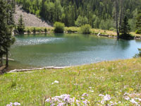
 To get to Miners Basin, drive almost 8 miles south from the center of town on Highway 191 and turn left at the Ken’s Lake–La Sal Loop sign. Then take a right at the “T” intersection. That will put you on Spanish Valley Drive, which becomes the La Sal Loop Road. You will drive by the Geyser Pass, Oowah Lake and the Warner Lake Roads before you get to the sign on the right directing you in to the Miners Basin Road, which is approximately 20 miles from the “T” intersection. When you finally get to the end of the road, there’s a parking area, an outhouse, a Forest Service kiosk and a small stream-fed pond that is so clear you can easily see the fish as they swim to the surface. To get to Miners Basin, drive almost 8 miles south from the center of town on Highway 191 and turn left at the Ken’s Lake–La Sal Loop sign. Then take a right at the “T” intersection. That will put you on Spanish Valley Drive, which becomes the La Sal Loop Road. You will drive by the Geyser Pass, Oowah Lake and the Warner Lake Roads before you get to the sign on the right directing you in to the Miners Basin Road, which is approximately 20 miles from the “T” intersection. When you finally get to the end of the road, there’s a parking area, an outhouse, a Forest Service kiosk and a small stream-fed pond that is so clear you can easily see the fish as they swim to the surface.
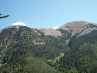
On a cool brisk day, majestic peaks stare down beneath a flawless blue sky as I start strolling east from the parking lot to make the connection to the Miners Basin Pass Trail (#040). It is a stunning walk with constantly changing views of Mineral Peak, Mount Waas and Green Peak. At the sign for the Trans La Sal-Warner Lake Trail, I take a right. Running north to south through Miners Basin, the Trans La Sal Trail skirts the entire western side of the La Sals starting in South Mountain and ending at the Gateway Road just beyond Castle Valley. This section of the trail is open to hikers, horseback riders and mountain bikers, but closed to motorized vehicles.
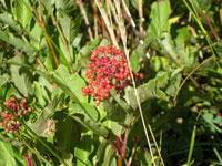 As the path swings south it enters a meadow filled with showy daisies, striking scarlet red elderberries, alpine sunflowers and fields of clover edged by mesmerizing quaking aspens. A makeshift pile of logs helps me across the only stream on the trail. In this moist area the squawbush is pregnant with their almost ripe berries. After passing by a big red metal gate, I begin a serious climb moving up the north-facing slope to an old mine with a loading dock precariously situated in the path of a talus slope and avalanche chute. At this spot the raspberries have ripened and I can’t resist a berry-picking time-out. As the path swings south it enters a meadow filled with showy daisies, striking scarlet red elderberries, alpine sunflowers and fields of clover edged by mesmerizing quaking aspens. A makeshift pile of logs helps me across the only stream on the trail. In this moist area the squawbush is pregnant with their almost ripe berries. After passing by a big red metal gate, I begin a serious climb moving up the north-facing slope to an old mine with a loading dock precariously situated in the path of a talus slope and avalanche chute. At this spot the raspberries have ripened and I can’t resist a berry-picking time-out.
Just after the old mine, a cairn marks the right fork of the trail where it departs from the old road. On this shadier moister side where the snow lingers longest, the spruce and firs thrive and project their mysteriously deep, dark shadows. The layers of moss, pine needles and cones that have gathered on the trail provide a soft cushion beneath my feet. I relish the sublime silence as two does disappear into the hidden fortress of the woods. The only sound I hear is the steady tap, tap, tap of the tiny camouflaged brown creeper, who is working his way up the tree searching for bugs and larvae hidden beneath the bark. When he reaches the top he flies down to the bottom of another tree and starts all over again.
 On a brief stint through a bright sunny meadow I am suddenly seeing the light of day before returning to the woods. Then after a few final switchbacks I’m on top of the pass, a small dry grassy opening in a vast terrain of evergreens. In contrast to the heated valley below, this lofty retreat is cool enough that the sun actually feels good. On a brief stint through a bright sunny meadow I am suddenly seeing the light of day before returning to the woods. Then after a few final switchbacks I’m on top of the pass, a small dry grassy opening in a vast terrain of evergreens. In contrast to the heated valley below, this lofty retreat is cool enough that the sun actually feels good.
I recognize the old log that I have rested on before and with time to spare, I plop myself down to watch the tips of the trees sway and moan with the whims of a restless breeze. A squirrel shrieks his scolding chatter, which contrasts sharply with the chickadees’ appealing “dee-dee-dee” calls.
As the sun sinks lower, the urge finally hits to move back down the way I came. At the stream crossing I stop to gaze upon the opposite slope when a big rock I’m looking at starts to move! I grab my binoculars to scope it out and what pops into view but a bull elk endowed with a massive rack! A female wanders into sight. Is this the beginning of the rut when he’s starting to collect his harem? I have read that elk are the most polygamous deer in America - a bull may 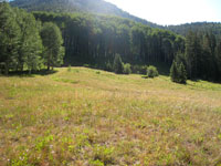 gather up to 60 cows. In the process he performs strange activities like rolling in wallows of stagnant water and mud. He also urinates on vegetation, which he proceeds to catch with his antlers to toss over his back. Elk are usually active at dusk, dawn and during the night, so this sighting in mid-afternoon comes as a wonderful surprise and a superb way to finish up the summer. gather up to 60 cows. In the process he performs strange activities like rolling in wallows of stagnant water and mud. He also urinates on vegetation, which he proceeds to catch with his antlers to toss over his back. Elk are usually active at dusk, dawn and during the night, so this sighting in mid-afternoon comes as a wonderful surprise and a superb way to finish up the summer.
Yes, summer is now gone but there’s still time to enjoy the aura of the high country before deep snow shuts the trails down. Unless winter sets in early, hiking in the La Sals, especially in the foothills, should be do-able through the end of October. Get up there and enjoy that fall flavor while it lasts. Who knows, you might even hear the bugling of an elk!
|
Biological Soil Crust (aka)
Cryptos (krip’ tose):
The surface of
Moab’s desert is held
together by a thin skin of living organisms known as cryptobiotic
soil or cryptos. It has a lumpy black appearance, is very
fragile, and takes decades to heal when it has been damaged.
This soil is a critical part of the survival of the desert.
The cryptobiotic organisms help to stabilize the soil, hold
moisture, and provide protection for germination of the seeds
of other plants. Without it the dry areas of the west would
be much different. Although some disturbance is normal and
helps the soil to capture moisture, excessive disturbance
by hooves, bicycle tires and hiking boots has been shown
to destroy the cryptobiotic organisms and their contribution
to the soil. When you walk around Moab avoid crushing the
cryptos. Stay on trails, walk in washes, hop from stone to
stone. Whatever it takes, don’t crunch the cryptos
unless you absolutely have to! |
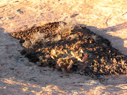
Cryptobiotic soil garden
|
|
|
 Reluctantly I wrapped up my idyllic summer sojourns with a hike in Miners Basin; a favorite haunt because it is an outdoor experience steeped in the historical lure of gold. The rush for riches started over a hundred years ago when mines mushroomed everywhere around the basin, and at the breathtaking elevation of 9300 feet a town referred to only as “The Basin” was born. By July 1898, the population had swelled to 70, and that included twelve women. This bustling town had a grocery store, two restaurants, two saloons, a hotel and boarding house where dances were held, livery and feed stable, shoemaker’s shop, mining office, recorder’s office, a deputy sheriff, and a post office. Some old buildings and mines have survived the elements and what remains is just enough to spark the imagination of a populace that lived here over a century ago. The gold discovered in 1897, however, turned out to be a low-grade ore, and with an economic downturn in 1907 the boom turned to bust. By 1910 probably fewer than a dozen people remained.
  To get to Miners Basin, drive almost 8 miles south from the center of town on Highway 191 and turn left at the Ken’s Lake–La Sal Loop sign. Then take a right at the “T” intersection. That will put you on Spanish Valley Drive, which becomes the La Sal Loop Road. You will drive by the Geyser Pass, Oowah Lake and the Warner Lake Roads before you get to the sign on the right directing you in to the Miners Basin Road, which is approximately 20 miles from the “T” intersection. When you finally get to the end of the road, there’s a parking area, an outhouse, a Forest Service kiosk and a small stream-fed pond that is so clear you can easily see the fish as they swim to the surface.
  As the path swings south it enters a meadow filled with showy daisies, striking scarlet red elderberries, alpine sunflowers and fields of clover edged by mesmerizing quaking aspens. A makeshift pile of logs helps me across the only stream on the trail. In this moist area the squawbush is pregnant with their almost ripe berries. After passing by a big red metal gate, I begin a serious climb moving up the north-facing slope to an old mine with a loading dock precariously situated in the path of a talus slope and avalanche chute. At this spot the raspberries have ripened and I can’t resist a berry-picking time-out.
 On a brief stint through a bright sunny meadow I am suddenly seeing the light of day before returning to the woods. Then after a few final switchbacks I’m on top of the pass, a small dry grassy opening in a vast terrain of evergreens. In contrast to the heated valley below, this lofty retreat is cool enough that the sun actually feels good.
 gather up to 60 cows. In the process he performs strange activities like rolling in wallows of stagnant water and mud. He also urinates on vegetation, which he proceeds to catch with his antlers to toss over his back. Elk are usually active at dusk, dawn and during the night, so this sighting in mid-afternoon comes as a wonderful surprise and a superb way to finish up the summer.