Hiking Happenings
August 2006
Cool Up
by Rory Tyler
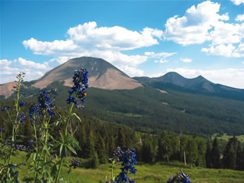
Moab sits at 4,000 feet above sea
level. Geyser Pass, in the La Sal Mountains, is a forty-five
minute drive from town and sits at 10,500 feet. It is significantly
cooler than the searing canyons far below. At Geyser Pass
there are lovely meadow walks and direct routes to some
higher peaks.
But, even before you arrive at the Pass, you have excellent
hiking opportunities in Gold Basin. To get on the Geyser
Pass Road take the La Sal Loop Road 23 miles from town
and turn right at the sign. The Geyser Pass Road is graded
gravel and passable for all vehicles. The Gold Basin Road
is 7 miles from the Loop Road and Geyser Pass is 8.
Gold Basin is a good place to go if you want to climb a
peak. Take the Gold Basin Road .9 miles from the junction
and look for the “No Snowmobiles” symbol on
your left. That’s the trailhead…an old dozer
track. This is the access to Brumley Ridge, which takes
you to Laurel Peak, the hub of the three-peak complex comprising
the central La Sals. The route is straightforward if you
hold to the ridgeline. It takes at least an hour and a
half of robust hiking to get to Laurel Peak. From there
it takes another half-hour to ascend Mt. Mellenthin (Mel),
to the north, and at least an hour for Mt. Peale or Mt.
Tukhanikivats (Tuk, rhymes with uke) to the south. While
Peale is a straightforward slog, the ridge leading to Tuk
is rather treacherous and should not be attempted by the
less-than-intrepid. Nor do I suggest a descent down any
of the rocky slopes and ridges that radiate from these
three peaks, or any of the La Sals for that matter. This
scree is nothing but megatons of sharp, tippy granite on
steep, unstable angles. Nasty.
If exorbitant effort doesn’t appeal to you, you can
drive another mile to the Gold Basin Trailhead and mosey
along the streamside through the woods and meadows. It’s
about two miles to the lovely central cirque. The main
trail heads left after you cross the fallen aspen a quarter
mile from the parking lot.
At Geyser Pass the main fork of the road goes right. Hikers
go left toward Moonlight Meadows and Burro Pass. You encounter
Moonlight Meadows immediately. The road (4WD) goes another
half mile to the base of Burro Ridge. It’s an hour
and a thousand feet up to the top of Haystack Mountain
to the west, which has a great view of the canyons and
the mountains. The first forty minutes is a piece of cake,
but the last twenty is abominable scree.
It’s a mile drive from the Geyser Pass to the Burro
Pass Trailhead. From here you can easily access the northern
La Sal Peaks. It’s about a mile walk to Burro Pass
with a thousand foot climb, and another hour and thousand
feet to Mann’s Peak to the north. The footing is
excellent. From Mann’s Peak you can connect along
the ridgeline with the summits of the north range, an excellent
place to be you if want to make a long day of it.
Rory Tyler is available
for cowboy poetry/campfire song gatherings which include
lore, science, history and lies of the Moab area. (Suitable
for all age groups). Rates are negotiable. Give Rory
a call at 435-260-8496.
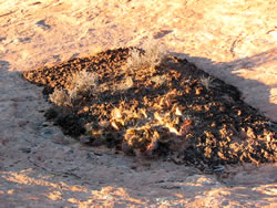
Cryptobiotic soil
garden
|
|